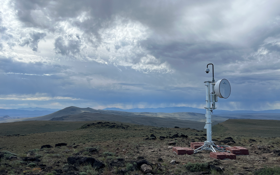
(Pictured above: Acty Mountain camera in Harney County. Each camera can rotate 360 degrees, tilt 220 degrees, and zoom up to 40 times. With near-infrared capabilities, they have a range of up to 30 miles in the day and 40 miles at night.)
Sponsored content contributed by AOC Business Partner: University of Oregon
The frequency and severity of wildfires are rising, driven by climate change, decades of fire suppression, and growth in the wildland-urban interface. But a lab at the University of Oregon has deployed a wildfire intelligence platform that gives counties new tools to spot and track wildfires.
The Oregon Hazards Lab at the University of Oregon (OHAZ) is now part of the world’s largest network of public wildfire cameras. OHAZ has installed dozens of cameras on telecommunications and lookout towers with long-range, 360-degree views of the surrounding landscape. Together, they enable firefighters to discover new ignitions, receive visual information to inform suppression efforts, and monitor fire behavior through containment while keeping people out of harm’s way.
OHAZ has been able to rapidly grow its wildfire camera network thanks to funding by the Oregon State Legislature, the Bureau of Land Management, the U.S. Forest Service, the Federal Emergency Management Agency, public utilities, and local partners. There are currently 57 cameras in Oregon, with plans to deploy 75 cameras by the end of 2025 and hundreds more in future years.
In addition, U.S. Senators Ron Wyden and Jeff Merkley directed funds this year to OHAZ to implement recommendations of the Oregon Wildfire Detection Camera Interoperability Committee. The committee is co-chaired by OHAZ and the Oregon Department of Forestry and aims to increase cooperation between agencies in detection camera efforts.
View Wildfire Cameras on the ALERTWest Platform
Any member of the public can view live and timelapse camera footage by visiting ALERTWest.live. This platform displays over 1,200 cameras operated by OHAZ and universities in other western states. In August 2024 alone, more than 12,000 unique users watched Oregon’s wildfire cameras, showing the impact that these tools can have on public safety and situational awareness during fire season.
Emergency managers, firefighters, and other stakeholders with public safety needs can receive login credentials to ALERTWest that allow them to rotate, tilt, and zoom the cameras to monitor specific wildfires. Credentialed users can also receive automated alerts when a new ignition is detected in their region. Over 200 officials from more than 50 different agencies in Oregon currently have camera credentials, including county governments; local utilities, police departments, and fire departments; and land management agencies.

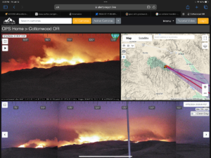
The Cottonwood camera enabled firefighters to monitor the Cow Valley Fire in July 2024. Every two minutes, ALERTWest software takes a panoramic image from each camera and scans the images for new ignitions using wildfire detection algorithms. ALERTWest employees confirm detection validity and then deliver alerts to credentialed users.
County Partnerships Bolster Community Resilience
County partnerships are at the heart of OHAZ’s success. More than simply using login credentials to watch for fires, county governments are integral to the camera network’s expansion and operation. They are crucial partners in hosting camera sites and providing access to the power and telemetry needed to keep cameras operating 24/7. These collaborations reflect the shared commitment of OHAZ and Oregon’s counties to safeguard rural and urban communities alike from the increasing threats posed by wildfire and other hazards. To date, OHAZ has deployed cameras in 19 of Oregon’s 36 counties, which have been valuable resources for monitoring the conflagrations that burned 1.9 million acres across the state in 2024.
OHAZ’s role does not stop with wildfire monitoring. It has also been a key player in Oregon’s efforts to prepare for earthquakes for a decade. The lab continues its work to expand the Pacific Northwest Seismic Network (PNSN) and strengthen the ShakeAlert Earthquake Early Warning System, which provides precious seconds of warning before dangerous seismic shaking arrives, giving counties the opportunity to protect residents and infrastructure from catastrophic damage.
OHAZ is working to secure additional funding to continue and expand its critical work. Counties interested in supporting OHAZ’s efforts at the state and federal level are encouraged to reach out to Joe Erickson at jerickson@uoregon.edu for more information on how they can help advocate for this critical resource.
OHAZ Wants to Work with Your Community
Emergency managers, firefighters, and other individuals with a public safety mission can email wildfirehelp@uoregon.edu to receive control and alerting credentials for Oregon cameras. Local governments can also email the lab to learn more about hosting camera sites in their county and to receive outreach materials for their residents. Together, we will be ready for next fire season, with an eye in the sky from the High Desert to the Cascade Range, from the forests to your town.
The Oregon Hazards Lab is a hazard monitoring group within the University of Oregon’s Department of Earth Sciences. OHAZ is developing a regional sensor network for understanding, detecting, and mitigating multi-hazards in the Pacific Northwest. The data collected by its instruments advance knowledge of natural disasters and the environment, protect the public through real-time alerting, and contribute to community-level resilience.

